Hey blog buddies, I can't believe how far behind I am with posts on my blog lately. I've been meaning to make a post for the bridge walk for over a month now.
For those of you who aren't familiar with my home city of Cornwall, Ontario, I'll give you just a very quick overview.
For the longest time, we were mainly known for our stench, as a paper mill town. If you've ever passed through a city/town with a paper mill, you'll know what I mean by the smell. For the most part of my life, I lived at the far end of town way east of the paper mill, so the smell wasn't an issue, but any time we'd drive near the factory the smell was unmistakable. The stink is mainly caused from the boiling of the wood pulp in chemicals to soften and bleach it. The paper mill actually shut down operations several years ago, and 90% of the vast property and buildings have been cleared.
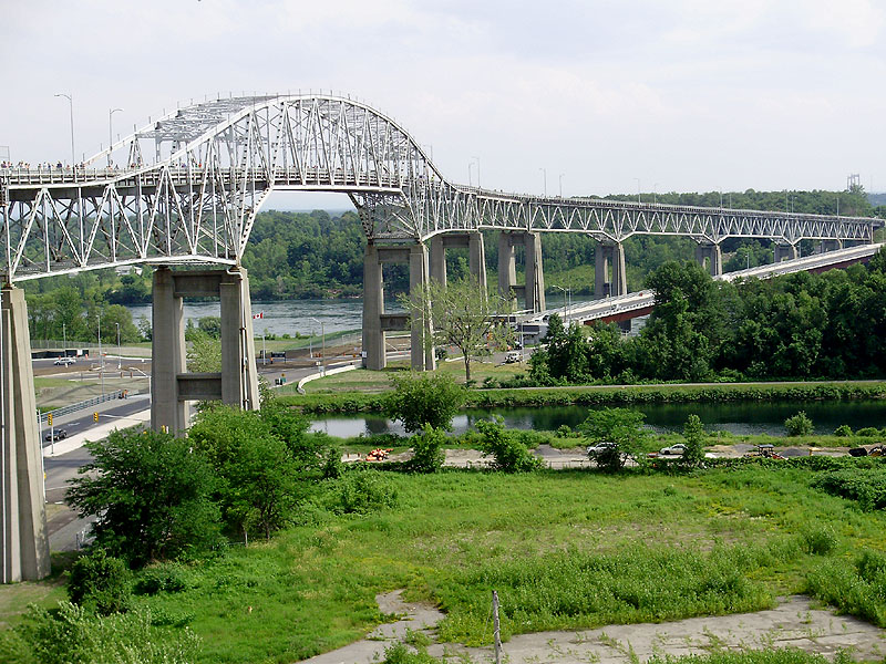
One of the other major landmarks in Cornwall is the Seaway International Bridge, which connects Cornwall to Cornwall Island (Native Reserve) and then leads to New York state (USA) by a second (suspension) bridge.
A few bridge facts:
- Built in 1962.
- 3000 tons of rebar were used in the construction of the deck.
- 41,000 tons of concrete were used.
- The bridge contains 5700 tons of steel girders.
- It took 32,000 gallons of paint to paint the bridge.
- The bridge is 120 feet high. The bridge was originally built to allow tall ships to pass underneath it, but none ever did.
- The bridge cost 8.2 million to build in 1962, which is roughly equivalent to 43 million today.
- 78% of the bridge is over land.
- Over the past 52 years, 78.2 million cars and 3.9 million transports have crossed the bridge.
That said, the bridge is being demolished starting this week. A new (and short) low bridge has been built, and is already in use, and will replace the old bridge. The old bridge has been costly over the years to maintain, and is in pretty poor shape (as you'll see from the photos).
I had been hoping to be able to make it onto the bridge to take photos for several months, but as soon as the new bridge went into operation, the old bridge was barred-off with a barbed-wire fence.
Then, in early July, just a few days before the event, I saw on Facebook that the Seaway International Bridge Corporation was going to open the bridge to everyone for the "Final Bridge Walk" which was to take place Tuesday July 8th, from 2pm to 8pm. I found it a bit odd (and unfair to a lot of people) that the bridge would only be open to the public for such a short time, and on a Tuesday (when a lot of people would be at work), but I made plans with my boss to leave a bit early for the event.
I left work around 3pm, and I made it to the bridge around 3:45 or so. This was a VERY hot and hazy summer day. One of the hottest days this summer.
When I arrived, I was pleased to see that MANY people had turned up for the event.
The first portion of the bridge has tall chain-link fences, so some photos were difficult (or a bit tricky) to take.
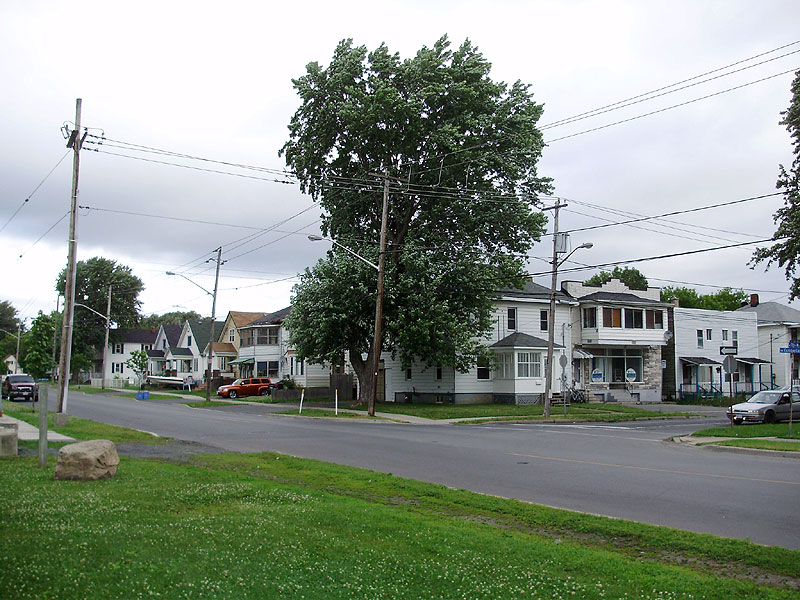
This photo shows Brookdale Ave. on the east side of the bridge. The east side has the majority of Cornwall, while the west end has smaller subdivisions, and newer neighbourhoods. Directly to the west of the bridge is actually the Howard Smith Paper Co./DOMTAR paper mill property. As I was touring/walking on the bridge, all the first photos focused on the east, and I planned to take photos of the west side on my way back, since there was much less to see on that side.

Here is a good photo that shows the condition of the deck. 52 years of patch work in every conceivable material has taken its toll on the roadway.

One of the old lights. The gaps in the fence on each side of the lights provided the only easy way to take good photos.

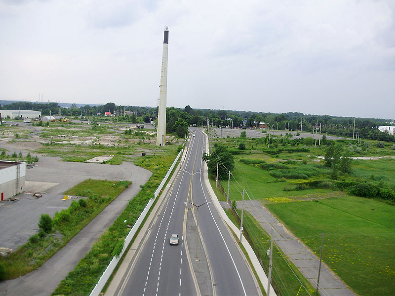
Here's a good shot pointing north-east towards my house (completely obscured by a tree, but visible later). In the FAR distance (under the crane), you can see the water tower.

Cornwall Water Tower:

A little farther down, my house was visible. It was easy to spot by looking for my neighbour's distinctly shaped front porch.

Note the three houses with the triangular pointed roofs to the left. Here's the "ground" view of my place, also showing those three houses.
This was the best "bird's eye view" (zoomed-in version of the earlier photo) that I was able to get of my house 'as viewed from the bridge'.


This was farther down the bridge.

Some of the views of the bridge may seem odd, as this one below, because the bridge actually has an "S" shape, so the curves allowed for some neat photos. Showing west side. You can see the second bridge in the distance at the upper right. You can also see the new low bridge at the bottom right.
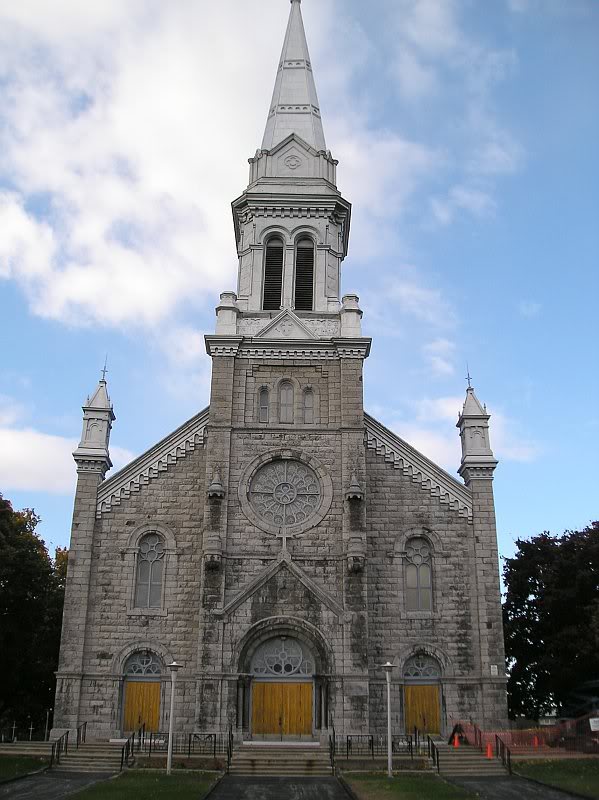
General view of Cornwall/downtown. If you look very closely on the far right, just barely touching the horizon is the dark brown-black steeple of Trinity Church (my favourite church). I made an entire post over a year ago, showing the interior of the church (along with a video clip that shows the exterior) here:
My 1923 Foursquare - Cornwall Homes - Trinity Anglican Church

The church steeple in the centre top is St. Columban's which will be shown again. Here's a photo from the ground that shows this church. The church is a few blocks east of my house.
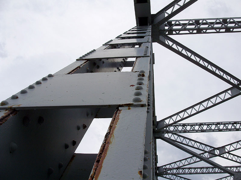
Centre of the bridge/girders.

A shot straight down Water Street, which then turns into Montreal Rd. (Hwy 138 South). The park along the waterfront is Lamoureux Park, and it's the location where all our outdoor concerts/events, hot air balloon festivals, and Canada Day celebrations take place. There is actually a carnival that was going on at the time, and you can spot a Ferris wheel.
Also visible in this photo is Nativity church (the church I attended as a kid) with the red roof (just right of the centre, and actually on the same street, which curves).
There is also a white dot visible on the horizon, just left of the centre road, and this is the ball over the
Nav Centre (formerly Nav Canada) building (see image below).

Here are two photos of Nativity Church. This first black and white photo was photographed by Cory Marsolais from the apartment building directly across from the church.

Here is a shot of the interior of the church, taken by Richard Pilon. The interior is beautifully painted in light blue and gold, and features ornate oak woodwork.

A small paragraph of info about the church can be found here:
http://www.cornwall-lacac.on.ca/bignativity.html
This is an overall view of Nav Centre (viewed from the river, pointing north):

To give you a rough idea of distance, it would take me about 30 minutes to walk to the church (from the bridge), and another 40-50 minutes to walk all the way to Nav. It doesn't look that far in the photo, but it's quite far.
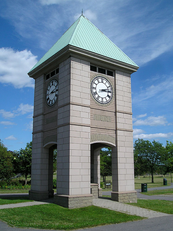
Also just barely visible in the park is the clock tower. If you scroll back up to the photo and look just a bit south of the red church roof, near the road in the park is a tiny triangular roof (just over a dark tree top), which is the roof of this clock tower:
This shot is taken from the same spot, but turned towards the north. Again, you can see St.Columban's church,

This is past the portion of the bridge with the chain link fence, and this time, looking to the west across the St. Lawrence river. The portion to the right is part of the old canal system, and to the right of this is parts of the old DOMTAR/paper mill property.

In the distance above, you can sort of see the Saunders Hydro-Electric Dam. Here's an up-close photo of the dam by Dean. I have other photos farther down. If you want information about the dam, have a look here:
http://en.wikipedia.org/wiki/Moses-Saunders_Power_Dam

Another shot of Cornwall, a little farther down the bridge. In the lower right is part of the new border/customs location as part of the new bridge. The water here is part of the old canal.

Another shot back on the west side, showing the remains of the former paper mill.

I took some photos with the railings partly to show how low they are. They come up just above knee-level, and made me quite nervous. In the distance is the dam.

West side, showing some of the curvature of the bridge. Again, the water here is the canal, not the river.
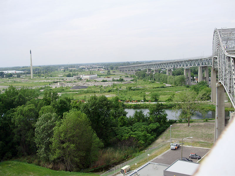
Here is the brand new low bridge. It was built right alongside the old bridge on the west side. This is the portion that spans the St. Lawrence river.

Here's a close-up of the dam. In the water, you can spot one of the old piers from an old train bridge, which collapsed long ago (early 1900s).


I'm not a huge "selfie" guy, but I took a few with a great view of the city behind me. It was starting to get cloudy at this point.

I like this one because you can see the steel girders in the sun glasses.

More artsy/interesting photos.


Second street (one of the main roads through town) looking west. This smoke sack was attached to the huge main building of the paper mill, to the left of the road. There were originally plans to blow it up in a big celebration, and have a big draw for who would win to push the button, but apparently there were too many concerns about carcinogens/chemical residues from all the dust it would create, so nothing has been done with the stack for a few years now. It's one of the last remaining things left to demolish on the property.
All the residential areas to the west are a few blocks away past the trees.

One of the 2 main designs of expansion joints used on the deck.

Heading back into Cornwall (back to the starting point).

I finished the bridge walk just shortly before 5pm, and as soon as I got home, it started to rain.
Overall, it was a great afternoon, and they had the entire event really nicely set up. They had large placards (not shown) that had photos of the bridge's construction, along with the facts I noted earlier. They also had one or two spots where they were handing out free bottles of water (because it was insanely hot), and a few benches set up for people to sit. Near the middle of the bridge, they had sidewalk chalk and were letting people (lots of kids) write their names and draw on the bridge. It was too bad that my Mom couldn't come (she was at work) and that my friend Lynne couldn't come (she lives over in Ottawa).
I hope you guys enjoyed these photos!